Mexico's Energy
Mexico uses different energy sources and has the potential for a lot of bio energies like wind, solar and biomass energy. But Mexico uses mainly natural gas, petroleum and coal. Mexico is among the top oil producers and exporters in the world and has the third greatest geothermal energy production. Mexico is also home to the largest geothermal power stations in the world. But Mexico's main energy source is petroleum with 56 % , natural gas at 29% and coal at just 5%.
Thursday, 18 June 2015
Wednesday, 17 June 2015
Glacial Retreat
A glacier is a body of snow and ice that moves. They respond the precipitation and temperature so temperature and precipitation is the most important parameters to study climate change. They are the most visible indicators of climate change and the climate controls the glaciers behavior. They respond in terms of glacial length, mass balance and runoff. These are the direct indicators of the change in climate. The indirect changes include the advance and retreat of the glacier but is still a good signal for climate change. Climate change causes a variation in the amount of snow and ice lost by melting.
The Himalayas are the youngest and the highest mountains in the world and have the largest concentration of glaciers outside the polar caps. The glaciers feed the rivers of Asia and play a very large role in the metro logical condition in India. It has been confirmed that the northwest Himalayan region has warmed up at a much faster rate than the global average with a rise of 1.6 degrees Celsius from 1901-2002. Also there has been a decreasing trend in snowfall from 1989-2008. this will impact the amount of water that the glaciers will release to the rivers which in many parts of Asia is the main water source and this will lead to the ruin of crops and cattle. Agriculture that is effected by the water loss will have a negative impact on the economy.
In Antarctic Marine sediment cores show that ice shelves probably have not reached a similar minimum in at least 10,000 years. Climate change will have many other impacts on Antarctica. The retreat of coastal ice and loss of snow cover would result in newly exposed rock and permafrost providing new habitats for colonization by expanding and invading flora and fauna. But this might lead to invasion of non native species especially if introduced by human and could kill native species. There have been changes in all parts in the marine ecosystem in the west of the arctic peninsula. The reduced sea ice cover has created an imbalance in the population of krill and salps, the main eater of plankton. This will effect larger species like seals, penguins and whales whose populations have already declined a lot. This also effects the CO2 secretion in the southern ocean. Because of the loss in the population in large species there will be higher competition for fishermen to make money and could eventually lose their jobs.
Glacier National Park will be deeply effected by the loss of glaciers. The mountain snow packs hold less water and glacier water acts as a water bank by storing water and feeding creeks and rivers through out the dry season but snow fall melts faster and so the ice melts two weeks earlier in the spring. This impact the regions water supplies, wildlife, agriculture and fire management. There will be a loss in alpine meadows and will put high elevation species at risk of diminishing. With less water from the glaciers and the higher temperatures there will be higher risks of forest fires and will have a very negative impact on the tourism and could impact the regional air quality and increase the number of hot days.
The Impact on Tourism
Glacial retreat will have a bad impact on tourism in places with glaciers. In Glacier National Park tourism brings in 1 billion dollars annually because people want to see the glaciers and even if there is no glacier in that spot people can see what the glaciers make like snow caped mountains, waterfalls, lakes, wildflowers, alpine meadows, wildlife and the turquoise colour in Crater lake. But the blue in the lake is quickly fading because the colour is made by "glacier flour" which is finely ground rock powder made by glacier movements. But if the glaciers are completely gone so will the colour. A survey was given to tourists based on if they would visit if glacier park looked like it will in a century and 20% said that they would not visit at all and 40% said they would visit less often. In 2003 when wild fires burned across 10% of the glacier visitation fell by half and in august alone 258000 fewer people visited then in previous years. Overall, tourism will be greatly impacted in areas with glaciers because tourist what to see glaciers and what they make but when they are gone so are the tourists.
Glaciers in Mexico are melting fast. It is estimated that the glaciers of Iztaccihuatl, Orizaba's peak and Popocatepetl will disappear in the next 10 to 35 years and the glaciers are melting faster then they were predicted to.
Tuesday, 9 June 2015
Land Use and Agriculture in Mexico
Mexico uses only 8% of its land on houses, 11% on grazing and 7 % for firewood. Most of Mexico's land use goes to agriculture 74%. Growing crops is a very important aspect of mexico s agriculture, accounting foe fifty percent of agricultural out put. The main crops include corn, sugar cane, tomatoes, wheat, sorghum, lemons, limes, mangoes, avocados, oranges, beans and coffee. Mexico mainly used slash and burn agriculture for hundreds of years but recently the government has banned slash and burn agriculture so Mexicans are slowly turning toward more modern types of agriculture like mono culture especially economically successful crops like corn, tomatoes and coffee.
Mono culture
Pros
- reduced plant competition for nutrients, space and solar radiation
- control of unprofitable organisms
-maximize profit from growing economically successful crops
-cheaper for mechanized labor
-market driven
-cheap production
CONS
- Nutrient loss, after many times of the same crop fields may gradually lose their fertility. The result may be desertification, a situation in which land is infertile and unable to support growth of any kind.
-diseases-no genetic variance between plants
-reliance on fossil fuels, chemicals and technology
-environmental damage
- displacement of local crops
Poly Culture
Pros
-major crop failure unlikely due to genetic variance
-rotation of crops replaces nitrogen in soil
- pesticides and fertilizers not as necessary as different plant species and animals perform these functions
- multiple crops and markets
-short, medium and long term crops grown
Cons
-more knowledge intensive
-more difficult to mechanize and there fore much more expensive.
-Erosion, when fields are used next to each other in rapid succession, roots and temporary water shortages are lost and unable to prevent nutrients from leaving the area permanently.
Slash and Burn
Is the agricultural technique which involves cutting and burning of forests right before the rainy season to create fields. It is more common in tropical areas.
Pros
-proven more sustainable and about as productive as more modern energy intensive agricultural methods.
Cons
- deforestation- when practiced by a lot of people there is temporary or permanent loss of forest cover
- the ash of the trees that were burned return lots of nutrients to the soil
-crop off cuts are recycled on site so decomposition can occur returning nutrients to the soil
-cheaper to burn debris on site than mulch or to remove the debris off site
- biodiversity loss, when plots of land area are cleared the various plants and animals that lived there are gone. If a particular area is the only one that holds a particular species this could result in extinction.
- After the fire there is a spike in nutrients in soil but if no utilized the nutrients may leach and therefore reduce fertility of the soil.
- fires are risky and they may go out of control and cause damage and endanger lives and animals.
Thursday, 4 June 2015
Water use in Mexico
The documentary Flow was very interesting and alarming. I knew that the water has started to become scarce but i did not know that there was so much water is disappearing. The people who seem to be most effected are people from countries that have hot climates and are still developing. People seem to suffer more in those countries when they live in rural areas. Also, even though a lot of people are still unaware, the running out of water is extremely deadly. If water runs out everyone is in trouble no matter what race, age or gender. It is not like oil where if we run out we will be economically crippled but water is the key to life. Even the rich will be affected because I believe eventually water will be more valuable then money. I think there are two major reasons that water is starting to disappear is because global warming that is heating the earth and the fact that there is just to many people will too high demands. People need to get serious about conserving water so we will not run out for a long time.
Water use in Mexico
Between 1990 and 2010 Mexico had an increase in access to piped water supply in urban areas (88% to 93%) as well as in rural areas (50% to 74%). Yet there is still inadequate access in rural areas and lots of in adequate water service quality. Mexico is suffering the most in the northern and central parts in the country. In three Mexican cities water and sanitation services are provided by private companies as early as 2011 named Cancun, Castillo and Aguascalientes. The extent of water scarcity in mexico is so serious that the government released an advertising campaign titled "February 2010 the city may run out of water!". With an increasing demand and an increasingly limited supply, certain cities in mexico risk being void of water. With an increasing population Mexican residents of semi-arid and arid-northern, northwestern and central regions use an average of 75 gallons of water a day compared to the US that only us 50 gallons a day. Mexico is heavily dependent on under ground aquifers, as it continues to draw water from these sources to supply almost 70% of its needs. But the rate of extraction has far exceeded replenishment. Currently 101 of 653 aquifers in mexico are severely exploited. Land subsidence is a side effect with a city plunging 10 meters in the last century. Another way mexico gets water is by the tapping of water from the Cutzmala dam system. Huge pipes that used to expel waste water to prevent flooding are now being used to pipe water into the city from the dam system. But the dam is drying up and its water levels are falling rapidly. This dame provides one fifth of Mexico's water. Also the poor infrastructure of the pipe makes a loss of 40% of the water every second before reaching mexico.
Thursday, 21 May 2015
Deforestation in Mexico vs Canada
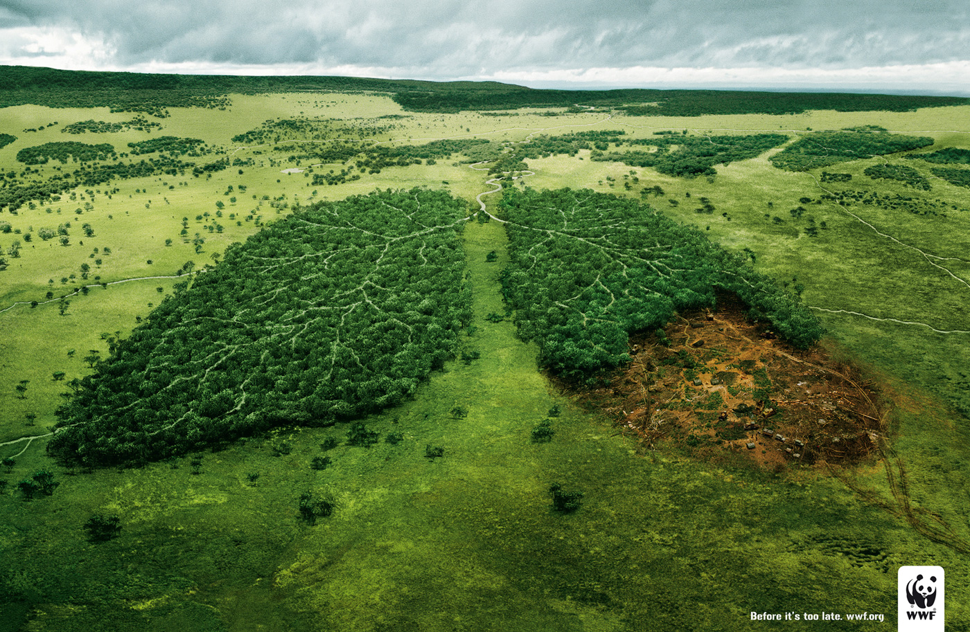
Deforestation is the permanent destruction of forests in order to make the land available for other uses. It is a major issue because it reduces biodiversity and affects water and soil quality and is an important contributor to climate change. Globally, 13 million hectors of forest are forested each year, the area of Nova Scotia and New Brunswick combined.
Mexico's deforestation is very bad.Before the Spanish conquest, about two thirds of the country was forested. But not all of it was virgin forests and evidence links deforestation to the down fall of great pre-conquest cities Palenque and Teoihuacon. Today less then one fifth of the country remains verdant, mainly in the south and east. Today deforestation remains a large issue because unlike most of the modern word a lot of mexico sees it as progress and not an environmental crisis. It is also a means for the poorest segment of Mexico's rural population to gain unclaimed land. Fifty percent of the farmers now live at subsistence levels, meaning they simply do not grow enough food to support their families. They ether move further into the forests and increase deforestation or migrate to the cities. The forests play an important role in supplementing incomes in the economy of the population of the forest regions. The Purepecha indigenous people have traditionally constructed their homes from wood. Firewood is one of the principle sources of energy in the area due to the fact that the people who live in the communities do not have the financial resources to buy gas.
Social and Economic Factors of Deforestation in Mexico
- incoherent development policies
- expansion of the agricultural frontier and agrarian distribution
- laws and policies favoring free felling
- the green revolution, wood cutting programs, agrarian law reform and policies that support cattle raisers
- inadequate participation of affected communities in decision making over the use and exploitation of natural resources
- lack of knowledge about technological and cultural advances in the rural and indigenous communities
- a lack of employment opportunities and a lack of environmental culture and awareness.
Profepa, the federal agency charged with protecting Mexico's natural resources, estimates that the country loses about 1.3 million acres of forest each year, the fifth worst deforestation rate in the world. Cattle ranching gas destroyed more than three quarters of the high forests that covered mexico at the turn of the century. Because of the deforestation many animal and plant species have died due to the loss of native habitats. In Caiaphas Lacondon rain forest. around 70,000 acres are cut down each year. The forest that originally was 15 million hectares and 90 percent has been converted to grazing pastures. Environmentalists predicted it could disappear within the next two decades.
Mexico's deforestation problem is a lot worse then Canada. Mexico is ranked as the fifth worst deforestation rate in the world. While Canada's deforestation rate is one of the lowest being only 0.4% of the global deforestation rate. Canada's forests take up 10% of the worlds forest cover. Mexico's deforestation rates are increasing while over the past thirty years Canada's deforestation rates have been decreasing. A portion of this deforestation in Canada is offset by increases in forest area due to afforestation which is planting of new areas of forests. Deforestation affected less then 0.02% of Canada's forests in 2005. In Canada 53% of deforestation goes for agriculture 19% urban development, 10% for hydro electricity, 10% for forest roads and 8% for industry and resource extraction. Canada also has some of the most rigid laws in the world for protecting forests and ensuring forest management. But for mexico , as seen above, do not have many laws protecting forests. One of the consequences of deforestation in Mexico is that it leads to soil erosion and flooding. Forests work as a natural sponge that soaks up excess rain waters and slow rivers that over flow their banks. Another problem is that in Mexico with the soil erosion from the deforestation shortens the life span of hydroelectric dams . Chiapas contributes a good degree of the nations electrical supply and continued deforestation threatens the capability of the plants to generate power.
Tuesday, 28 April 2015
1985 Mexico City Earthquake
At 7:18 in the morning Mexico city got a 8.1 magnitude earthquake, one of the strongest to ever hit the area. They effects were very bad because Mexico city is surrounded by mountains and volcanoes. The region was covered in lakes in ancient times to the city is on dirt and sand instead of bed rock and is very volatile during an earthquake. The earthquakes epicenter was located 50 km off the coast of mexico and 250 miles west of the city but unstable ground worsen the effects. Old hotels and factories made out of shoddy materials collapsed quickly and the tremors caused gas mains to break causing fires and explosions through out the city.
The mercalli intensity was IX (violent) and killed 10,000, injured 50,000 and made 250,000 people homeless. the average of 66-242,000 buildings and homes were destroyed in the earthquake. An aftershock hit on September 20 and had a magnitude on 7.5. The cost of the damage was estimated to be around 5 billion dollars.
Coco's plate subducton zone slid under the north american plate. Volatile trenches along the Coco's plate generally have had seismic events 30 to 70 years before 1985. However this particular section of the subduction zone had not had an event for a much longer time. Off the coast of Michoacan and Guerrero the earthquake caused a rupture in the sea bed 240 km long and 70 km wide, located between the subduction trench and the coast line. This is an inter tidal zone and the event caused widespread mortality in a number of species living in the area such as algae and shell fish.
Friday, 24 April 2015
MEXICO'S MANY PLATE TECTONICS
Mexico is located on one of earths subduction zones, where the ocean floor of the Cocos tectonic plate is sub-ducting beneath the continental plate of the north american plate. Subduction zones get earthquakes and sometimes they stick together (locking), the lower plate pulling the upper plate down with it and therefore causing stress to build up. When the stress builds up to the breaking point, the upper plate breaks free and springs back to where it was before. The lower plate moves very slowly, only around 6 cm per year which is as fast as finger nails grow. It takes many hundreds of years for stress to build up before causing a large earthquake.
Most of Mexico is on the north american plate but is also on several other plates. The Baja California Peninsula is on the gigantic pacific plate, which is moving northwest and under the north american plate. The intersection of these plates under the Gulf of California causes parallel faults which are part of the famous San Andreas Fault system.
The small Rivera plate, between Puerto Vallorta and the southern tip of Baja California is moving in a southeast direction and rubbing against the pacific plate it is also moving under the north american plate. The Coco's plate and tiny Orozco plate are ocean crust plates located off the south coast of Mexico. The collision of the Coco's plate and the north american plate had caused the disastrous 1985 earthquakes. ( Mexico is one of the most seismological active regions on earth. The motion of these plates causes earthquakes and volcanic activity.) Mexico is being carried northwest by the Coco's plate. The ocean floor is fairly dense, when it strikes the lighter granite of the Mexican land mass, the ocean floor id forced under the land mass, creating the deep middle american trench that is at Mexico's southern coast.
The westward moving land a top the north american plate is slowed and crumpled where it meets the Coco's plate, creating the mountain ranges of southern Mexico. The subduction of the Coco's plate accounts for the frequency of earthquakes near mexico's southern coast. As the rocks on the ocean floor are forced down, they melt and the molten material is forced up through weaknesses in the surface rock, creating the volcanoes in the cordillera Neovalcanica across central Mexico. Motion along the San Andreas Fault in the past pulled Baja California away from the coast, creating the Gulf of California. Continued motion along this fault is the source of earthquakes in western Mexico. September 1985 Mexico city was hit with a Richter scale of 8.1 magnitude earthquake from the subduction zone off Accpulco and killed 4,000 people in the city and Volcan de Calima, south of Guadalajara, erupted in 1994.
Friday, 17 April 2015
The Impact of Fishing
Fishermen- if fish stocks crash then fishermen will be out of a job.
Consumers- Fish costs will rise and then only the rich can afford to eat fish. people will lose an important part of their diet.
Government- fishing is economically important and if the fish stalks crash then the economy will suffer. Also the fishermen will have no work and the government will have to give out welfare to them and find jobs for them.
At the sea of cartes ( gulf of California) is one of the worlds top five seas in terms of ecological productivity and biological diversity. In the 1990's a long line fishing fleet began to operate off of Ensenada. A single long line boat may have 5 km of line with 600 to 700 baited hooks in total. The sword fish population outside of the 80 km protected zone were quickly depleted, leading fishing boat owners to apply for permits to catch shark inside the 80 km limits. Decades of commercial over fishing are causing total collapse of fishing stalks. As late as 1993 the area less then 5% of all Mexico's territorial waters produced about 75% of the nations total fish catch of 1.5 million tons has declined the fish population by 90% since then.
Fishermen- if fish stocks crash then fishermen will be out of a job.
Consumers- Fish costs will rise and then only the rich can afford to eat fish. people will lose an important part of their diet.
Government- fishing is economically important and if the fish stalks crash then the economy will suffer. Also the fishermen will have no work and the government will have to give out welfare to them and find jobs for them.
The environment- over fishing has killed many species of fish and has disrupted the equilibrium of the ocean. fish can not repopulate faster then the rate of fishing to the population of fish keeps on lowering. As certain species are hunted down other fish that eat those fish will lose a very important part of there diet and die as well.
Mexico's fishing industry
The shallow waters of the pacific coast and large amount of plankton in waters cooled by the Californian current makes for good fishing in the northwest. Together Sinaloa (23%) and Sonora (22%) make for about 45% of the national total. Fishing economically important in Veracruz (8%) and Baja California (6%). 72% of the total annual catch of 1.5 million metric tons is landed at pacific coast ports such as Guaymas, Mazatlan, Tampico. and Campeche ( golf coast parts) account for a further 25% each. The last 3% is in inland lakes and rivers and fish farms.
value wise the most important species are shrimp, tuna, and sardines. Fresh water fish farms are becoming more common, many are specializing in the production of high value species like trout and indigenous white fish.
Tuesday, 7 April 2015
Mining
The pros and cons of strip mining and open pit mining
Strip mining
PROS- Mine is largely hidden under ground so surface land can easily be used for other uses
- A process called ' back filling ' reduces cost of hauling and helps avoid fall of rock bursts.
Cons- Higher risks of cave ins
- higher risk of poisonous gas release
- AMD sulfide rocks are exposed to to surface air and water and give off acidic chemicals that drain into near by streams.
- less safe
Open Pit Mining
PROS- more efficient
- sampling each level of open pit mining is easier for surveyors to find the highest yield and avoid safety hazards
- can use larger trucks so can increase the yield per day.
- efficiency improvements reduce costs
- more safe
CONS- Very large environmental costs because vegetation is wiped out and lots of pollution
Spouse of a miner - choose the open pit mine because it is much safer then strip mining
Owner of mining company- choose open pit mining because it costs less and there is a higher yield and 40 percent of mining is on the surface
Enviomentalist- choose strip mining because it does not distroy surface life and there is a nuetralizer for the AMD.
Owner of near by ski resort- choose strip mining because it is not as visible from the surface so it will not get ride of costumers
Politician- choose open pit mining because it costs less and there is a higher yield for shipping.
Mexico mining
Mexico is the worlds leading world producer of silver and produces one fith to one third of the whole worlds silver
Subscribe to:
Posts (Atom)